The Best Headlamps for Night Hiking and Camping in 2026
Lumens, beam pattern, battery life and red-light modes explained. Picks for the best hiking headlamps at every budget, with what actually matters.
A phone is a navigation device with a four-hour battery and no signal.
Phone navigation is excellent until it is not, and it fails in a predictable pattern: the battery runs down, the signal disappears, or the screen becomes unreadable in bright sun or rain. Paper and compass do not have those problems. The realistic answer for most people is both, with the paper version carried as the fallback rather than the primary.
The decisions that actually change the outcome.
Matched to what you will actually do with it.
Use case: Every trip, as the non-electronic fallback
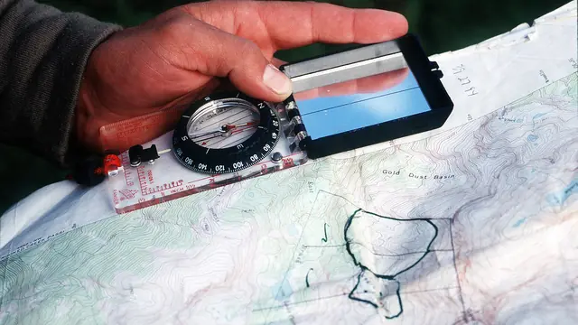
No battery, no signal, no failure mode. Learn to use it and it will outlast every electronic device you own.
Use case: Planning and as the primary reference in poor visibility
Shows terrain shape, water, and paths — the three things you navigate by. A laminated or synthetic sheet survives rain.
Use case: Expeditions, long treks and off-trail travel
Runs for days on two AA batteries and holds a recorded track you can follow back in whiteout. More rugged than any phone.
Use case: Anywhere without mobile coverage
The only item here that can call for help. A personal locator beacon has no subscription and does one job extremely well.
Use case: Every trip, as the primary convenience layer
Excellent when the battery and the screen cooperate. Download the region before you leave and carry it in aeroplane mode.
Some outbound gear links are affiliate links. If you buy through them we may earn a commission at no extra cost to you. This never changes which products we recommend.
The expensive ways to get this wrong.
Lumens, beam pattern, battery life and red-light modes explained. Picks for the best hiking headlamps at every budget, with what actually matters.
Learn seven essential navigation skills that work without a phone: reading topographic maps, using a compass, terrain association, pace counting, and natural navigation.
Learn how to read a topographic trail map, understand contour lines, and use a compass for basic backcountry navigation.